Cuenca Got Hit Hard by Floods — Here's What Happened and What's Still at Risk
What Happened
On March 12, President Noboa signed a 60-day national state of emergency in response to severe flooding and landslides that have hammered the country during this rainy season. The numbers are staggering:
- 200,000+ people affected across Ecuador
- 190 cantons (out of 221 total) impacted
- Floods account for 38% of all incidents, landslides 37%
- Weather-related emergencies are up 56% compared to the same period last year
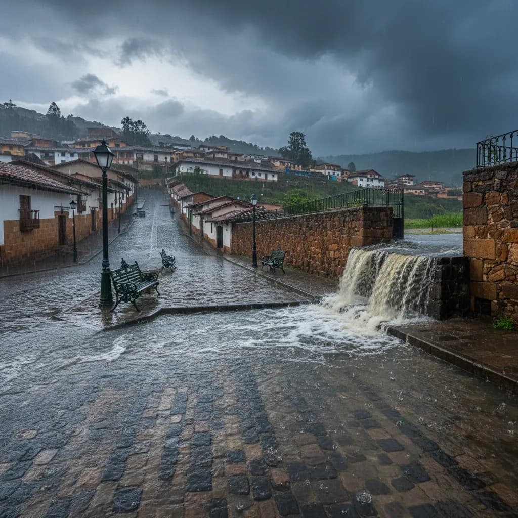
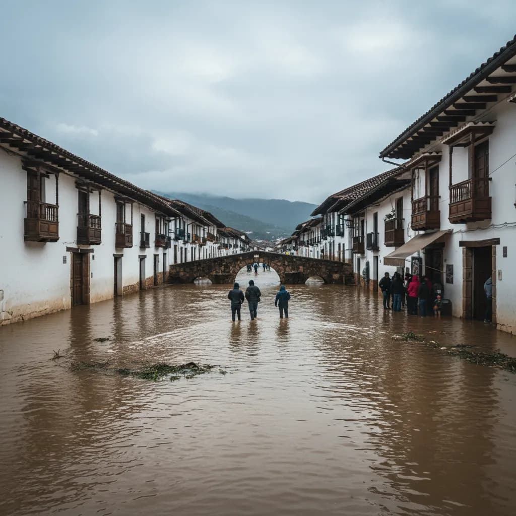
Cuenca hasn't been spared. Multiple neighborhoods along the Tomebamba, Yanuncay, and Machángara rivers experienced significant flooding, with water entering homes, damaging roads, and turning some streets into rivers.
Cuenca's Situation Right Now
Cleanup is underway across the city, but the risk isn't over. The rainy season typically runs through May, and saturated hillsides remain vulnerable to landslides — particularly in the western and southern parts of the canton.
Areas that saw the worst of it:
- Neighborhoods along the Tomebamba and Yanuncay rivers experienced overflow during peak rains
- Turi and surrounding hillside communities faced landslide risks
- Rural parishes outside the city center, where drainage infrastructure is weaker, took heavy hits
- Roads connecting Cuenca to the coast (particularly the Cuenca-Molleturo route) have been repeatedly blocked by landslides
The municipality and COE (Emergency Operations Committee) have been coordinating cleanup, but some areas are still dealing with mud, debris, and damaged infrastructure.
What the State of Emergency Actually Means
The 60-day decree allows the national government to:
- Redirect emergency funds without going through normal budget processes
- Deploy military and police for disaster response
- Fast-track infrastructure repairs on damaged roads and bridges
- Coordinate across provinces where multiple cantons are affected simultaneously
For day-to-day life in Cuenca, you probably won't notice much difference. There are no curfews or restrictions on movement. It's primarily a legal and fiscal tool to speed up the government's response.
Why This Year Is Worse
That 56% increase in weather events isn't random. Ecuador is experiencing particularly intense rainfall patterns this season, and the combination of deforestation on hillsides, inadequate drainage infrastructure in many areas, and increasingly unpredictable weather patterns is creating a perfect storm (literally).
Cuenca's rivers are beautiful, but they're also the city's biggest weather vulnerability. The Tomebamba alone has flooded multiple times in the past decade, and development along riverbanks continues despite the risk.
Practical Tips for Expats
Right Now
- Check your neighborhood's flood history — if you live near a river or at the base of a hill, know your risk
- Have a go-bag ready with important documents (cédula, passport, visa), medications, phone charger, and cash
- Keep your phone charged and have ECU 911 saved
- Don't drive through flooded streets — this is the #1 way people get in trouble. If you can see water on the road, turn around
For the Rest of Rainy Season
- Monitor weather alerts — INAMHI (Ecuador's meteorological service) posts warnings on their website and social media
- Avoid hiking or driving mountain roads during heavy rains, especially the Cajas and the Cuenca-Molleturo highway
- If you hear what sounds like a freight train coming from a nearby hillside or creek — move immediately uphill. Debris flows and mudslides sound exactly like that
- Renters: talk to your landlord about the building's flood history and whether there's a sump pump or drainage system
Emergency Contacts
- ECU 911 — call 911 for any emergency
- Bomberos (Fire Department) — they handle flood rescues
- SNGRE (National Risk Management) — the agency coordinating national response
The rainy season has at least two more months to go. Stay aware, keep an eye on the weather, and don't underestimate how fast Cuenca's rivers can rise.
Sources: Latina Republic, CuencaHighLife
Keep Cuenca's daily expat briefing independent.
Reader support helps pay for reporting, translation, editing, hosting, and the daily work behind CuencaExpat.